
I have never heard anyone say that they don’t like Stanley. This village on the far north-west coast is perhaps the most picturesque of Tasmanian towns, its historic buildings huddling around the base of a sheer, chocolate-brown slab of rock known as the Nut.
What is this Nut? It’s believed to be an ancient volcanic plug: a mass of magma that once upon a time hardened in a volcano’s neck or top. Sedimentary rock around it has been washed away over the millennia, leaving an abrupt bluff of teschenite, an extremely hard variety of rock. It stands at 143 metres above the sea.
When Matthew Flinders sailed by here in 1798, he described it as ‘a cliffy round lump resembling a Christmas cake’. Sailors in the next century thought it more resembled a nut. I see a cake more than I see a nut, but the Nut is a superior name.
The volcanic origins have created clay loam soils around Stanley, which make good pastures for sheep and cattle. It was for this reason that the settlement of Stanley came to exist in 1830, when the Van Diemen’s Land Company established its base here.
Founded in London in 1825, and privately financed, the VDL Company was nevertheless strongly supported by the colonial government. It had been allotted land for raising fine merino sheep, whose wool was in demand in Britain. Along with 250,000 acres of land, the company’s chief manager was given the position of Magistrate. Edward Curr would use this power and lack of scrutiny to his advantage. After knowingly dispossessing local Aboriginals of their lands, his men went on to perpetrate a massacre at Cape Grim, on Tasmania’s north-west coast.

The company’s original headquarters is perched on a hill opposite the Nut, still standing and open to visitors. The bluestone buildings were designed by surveyor and architect Henry Hellyer, one of their most brilliant but tragic employees. His Highfield was built of native stone, and of course from convict labour. It fell into dilapidation for some years, but was restored in the 1980s.
With the end of convict transportation, the VDL Co lost its provision of servants, and thus found itself in some difficulties. (The company still exists today, with its headquarters at Cape Grim. A tour bus driver tells me that it is Australia’s oldest publicly-listed company, but it has never been Australian-owned.) What had been the company’s township was thus divided into blocks of land in the 1840s and sold off to farming families, and Stanley was truly born as a town.
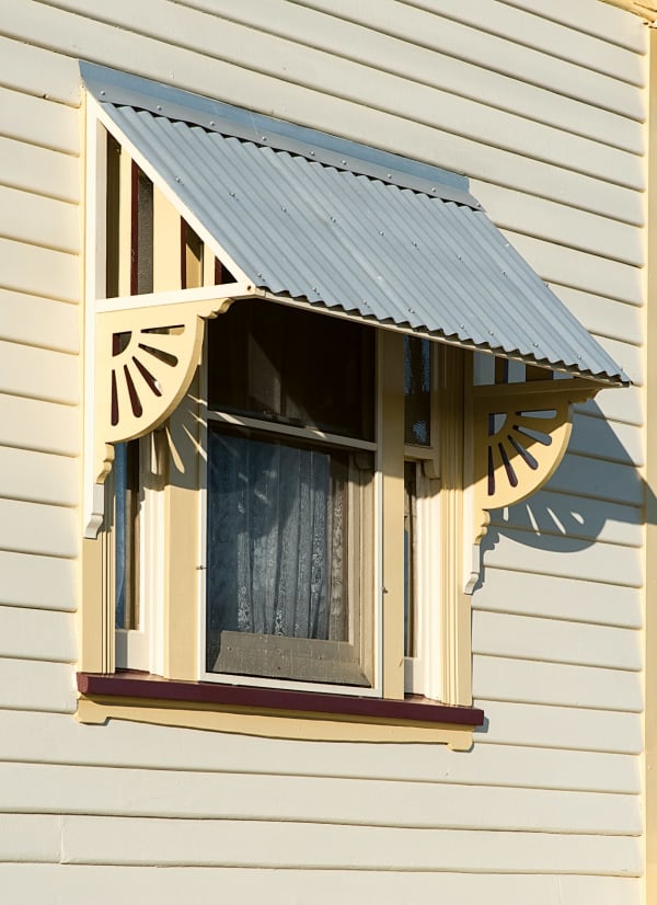
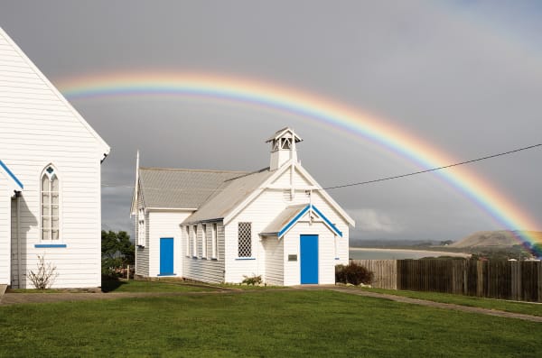
Highfield is far from the only historic building in the town. An intriguing example is the St James Presbyterian Church, bought as prefabricated building in London, freighted to Stanley, and re-erected. The whole thing cost about £400.
John Lee Archer was a significant figure in the early life of Stanley. He had moved there after working as the official colonial architect in Hobart. Upon shifting to Stanley, he performed a variety of official and magisterial roles, as well as designing the town, mapping its streets, and continuing to design buildings. He designed the VDL Co’s store in the 1840s. It was constructed with recycled bluestone, which had arrived as the ballast of ships. (Baltic pine, also of nautical origin, has occasionally been redeployed in Stanley’s buildings too.) The VDL Co store later was a house of detention, a customs house, a butter factory and a fish-processing factory. As is a la mode in Tasmania, nowadays you can stay in the old store – it’s a boutique hotel.


Archer’s ‘poet’s cottage’ on Alexander Terrace is also worth a visit. It was originally known as Ivydene and old photographs show its exterior walls blanketed with ivy. A handful of other inns and cottages from the 1830s and 1840s are also easily found. Different architectural eras are represented too. For example, the Edwardian house built by local lawyer Kenric Laughton in 1906 still stands. It is also repurposed as accommodation. It’s little surprise that Stanley won a recent gong for being Australia’s ‘top accommodation destination’.
Another building of interest is the birthplace of Joseph Aloysius Lyons, a quaint white cottage of weatherboard near the waterfront. Born in 1879, Joe Lyons would later become the only Tasmanian-born Prime Minister of Australia. He won the Federal election in 1931 at the helm his own party, the United Australia Party. Although he mostly lived elsewhere on the north-west coast (after dying in office, he was buried in Devonport), his early home is a fitting monument to a significant politician. It is open to the public and contains memorabilia relevant to Lyons’s life and career.
The preservation of such buildings is a big part of Stanley’s charm as a town. It also made it an ideal set for a blockbuster film, which was partly shot here in 2014. ‘It's a town that's completely intact architecturally,’ explained the makers of the Australia period drama The Light Between Oceans, set in the 1920s.

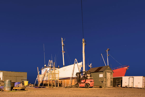
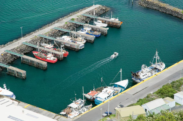
Some effort had to be made to remove evidence of the 21st century. The shops on Church Street retain their village charm, but their wares and services are somewhat more modern. There’s certainly no shortage of access to flat whites, home-made desserts, or scallop pies. In fact, the seafood in Stanley is of the highest quality; you’ll often see the fishing vessels returning to the waterfront with in a fresh catch. On a more recreational level, Stanley wharf is one of the most popular fishing spots in the north-west of Tasmania, with trevally runs frequent in the summer. For those who aren’t inclined to cast a line themselves, simply watching a score of anglers almost simultaneously wrestling in a catch can be entertaining enough.
Locals are also proud of their folk arts and crafts, much of which is derived from the place’s unique geography. On their walls, cafés hang landscape paintings from the region; other stores show (and sell) sculptures and jewellery made of driftwood, shells, stones, sea-glass, fishing refuse and other marine debris.
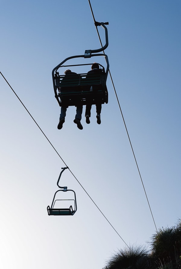
Stanley is full of fine details and close encounters with the landscape and seascape, but to understand what makes Stanley so likeable, observe it from above – from the top of the Nut. Visitors can be hoisted up the summit on a chairlift, but as always, it is a far better experience to simply walk up if one has the ability. A steep ascent leads to a couple of walking tracks that meander around the plateau. From atop the Nut, we can see a summary of Stanley: compact, bordered by rock and beach, exceedingly pleasant to look at.
The Nut’s panorama goes beyond cosy Stanley. The green hills inland were once forest, considered dismal by colonists, and by the explorers of the Van Diemen’s Land Company, who sought grassy acres for livestock. Now this rich, rain-fed country supports a significant dairy and beef industry.
To the east and west we see the rugged coastline – hard igneous rock roughly hewn by sea and time. Not far from here are the oldest exposed rocks on the island, formed more than 1.5 billion years ago: the planet’s first concept of Tasmania. This is at Rocky Cape, which is still known by the lovely name of pinmatik in the local Aboriginal idiom.
This was one of the region’s many important sites for Aboriginal society. Cape Grim was another; the first Tasmanians’ artwork is carved into preminghana (Mount Cameron West), just south of that promontory. Although it is obscured from general view, protected from the elements and left for those whose ancestors created it, just knowing that this indigenous art exists nearby lends the whole region a special air. This is storied land.


The content of this article first featured in Towns of Tasmania: A Journey Through Time, a book by writer Bert Spinks and photographer Pen Tayler. With the highest quality content and production values, Towns of Tasmania celebrates the unique style and spirit of Strahan, Stanley, Ross, Richmond, Evandale, Deloraine, Bothwell, Queenstown, Triabunna, Derby, Franklin and Beaconsfield.