“The coast as presented to us is completely strewn with the wreck and cargo of the City of Edinburgh, the vessel being literally shivered to atoms and a great part of her cargo washed ashore,” reported the Hobart Town Courier and Van Diemen’s Land Gazette in August, 1840.
Within a few hours of the wreck of the City of Edinburgh, another barque, the Ocean Queen, also came to grief in the waters off the west coast of Flinders Island. These were not isolated incidents. More than 100 ship wrecks have been recorded in the Furneaux Group, of which Flinders Island is the largest. Lying in the path of the Roaring Forties, with many rocky outcrops, uncharted reefs and small islands, and with unpredictable, treacherous seas and weather, the Furneaux Group was a natural shipping hazard for vessels sailing through the Bass Strait.
Despite the hazards of going through the Strait, they continued to risk sailing through the strait it because it was considerably shorter than sailing around the southern tip of Van Diemen’s Land.
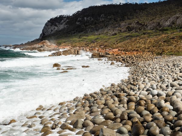
Today, with accurate mapping and modern navigation methods the risks have been significantly reduced and the coast around Flinders Island is better-known for its rugged beauty – although fishermen and sailors remain wary.
. . .
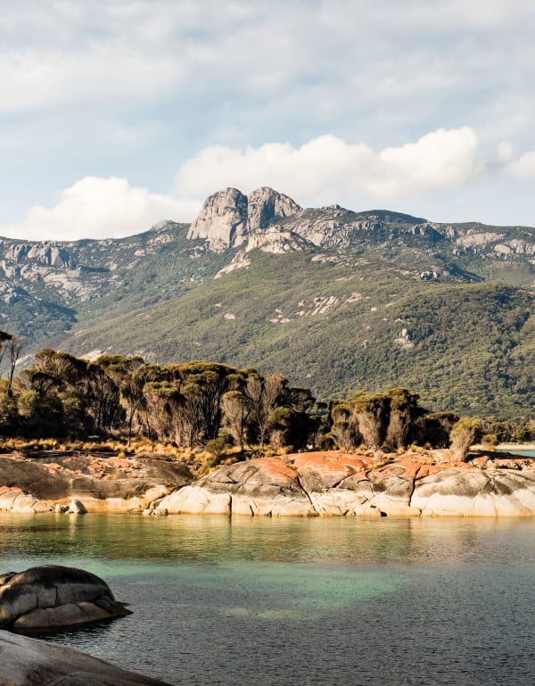
Unlike the stranded crew and passengers of the City of Edinburgh, and unlike the First Tasmanians forcibly relocated between 1834 and 1847 to a windswept part of Flinders Island just inland from where the barque was wrecked, I’ve come here to enjoy its isolation and natural beauty. The island is about 75km long and 40 wide. There are stunning white sandy beaches, orange lichen-covered rocks and ridges of granite, including Mount Strzelecki, the Darling range and Mount Killiecrankie where the famed Killiecrankie diamonds (a type of topaz) are found.
With my camera in hand, I’m happy to take whatever the weather brings, knowing I can always return to the warm cottage I’ve rented for the week. This wasn’t the case for the poor passengers or crew of the many ships that foundered on the dangerous seas.
The City of Edinburgh was on a voyage from the UK to Sydney in 1840 with merchandise valued at £50,000. All the way from the Cape of Good Hope until King Island, they had experienced “very heavy weather”, which continued as they attempted to sail through the Bass Strait. Somewhere near Pyramid Rock after a series of heavy squalls, a number of sails were split before the main yard and bowsprit were torn away. The deck was covered in debris from the mast and yards. It must have been a terrifying ordeal for the crew and passengers.
The captain tried to find a safe place to drop the anchor but it fouled and the ship drifted towards Great Island. For almost 12 hours the captain and crew worked to keep the ship safe, but they were fighting a howling wind, rain squalls and a pitch-black night. The ship drifted into breakers and, in the early hours of the morning, struck a reef near Settlement Point, Flinders Island.

Fortunately, the crew and passengers made it safely to shore.
As the shop broke up, the cargo got washed ashore too, and it proved too much of a temptation for the crew. Ignoring orders to help salvage the valuable cargo, they instead opened the wine and spirit casks and “ … were in a constant state of intoxication, during which time they were guilty of the greatest excesses”. Later, “packages were broken open and plundered, and a large quantity of valuable property has been secreted on the island”.
As I walk along the beach at Trousers Point, I wonder if anything remains of the valuables supposedly hidden on Flinders Island all those years ago. The sunlight glints off the crystal clear, azure water while a group of kayakers paddles past the few yachts anchored in the small bay.
. . .
It’s a warm, still day, and despite the craggy rocks around the coastline, I find it hard to imagine that not far from here a small schooner, the Sarah Anne Blanche, used for transporting cargo, such as potatoes, sawn timber and mutton bird oil, was wrecked in 1871. Driven out to sea from Chapel Island by high winds, it smashed onto the rocks south-east of Trousers Point.
The only crew member on board, a young man named Richard Burgess, managed to escape by crawling along the bowsprit, presumably before it too became nothing more than bits of broken timber. There is a suggestion that Trousers Point is so named because Burgess came ashore without his trousers.

Unlike the rocky west coast, the east coast of Flinders Island consists of long stretches of sandy beaches, but this didn’t prevent the City of Foochow from hitting a rock in 1877. The ship had left Newcastle full of coal and was bound eventually for Calcutta, but it ended up with the holds full of water and buried so deeply in the sand that it couldn’t be re-floated, despite the best efforts of the men who bought the wreck for £500.
Later during my visit, looking for potential photographs, I drive along West End Road past Tanners Bay, towards Egg Beach. Somewhere around here, according to the local map of Shipwrecks in the Furneaux Group, in July 1868, a schooner, the Anne, struck Hammock Island and was beached on Flinders Island, another footnote to the wrecks around the island.
Egg Beach is so-named because of the striking, wave-eroded spherical rocks covering the shoreline. Now a conservation area, it’s a great place to get a sense of how wind, water and weather work together to create the dramatic, rocky coastlines and windswept shores of the island. On a typical day, with the westerlies blowing, it’s also a good place to view wave action that might signify a partially submerged rock or a series of reefs waiting for the unwary.
And even today, walking along the coastline of Flinders Island, it’s possible to find bits and pieces left behind from the many ships and boats that didn’t make it through.
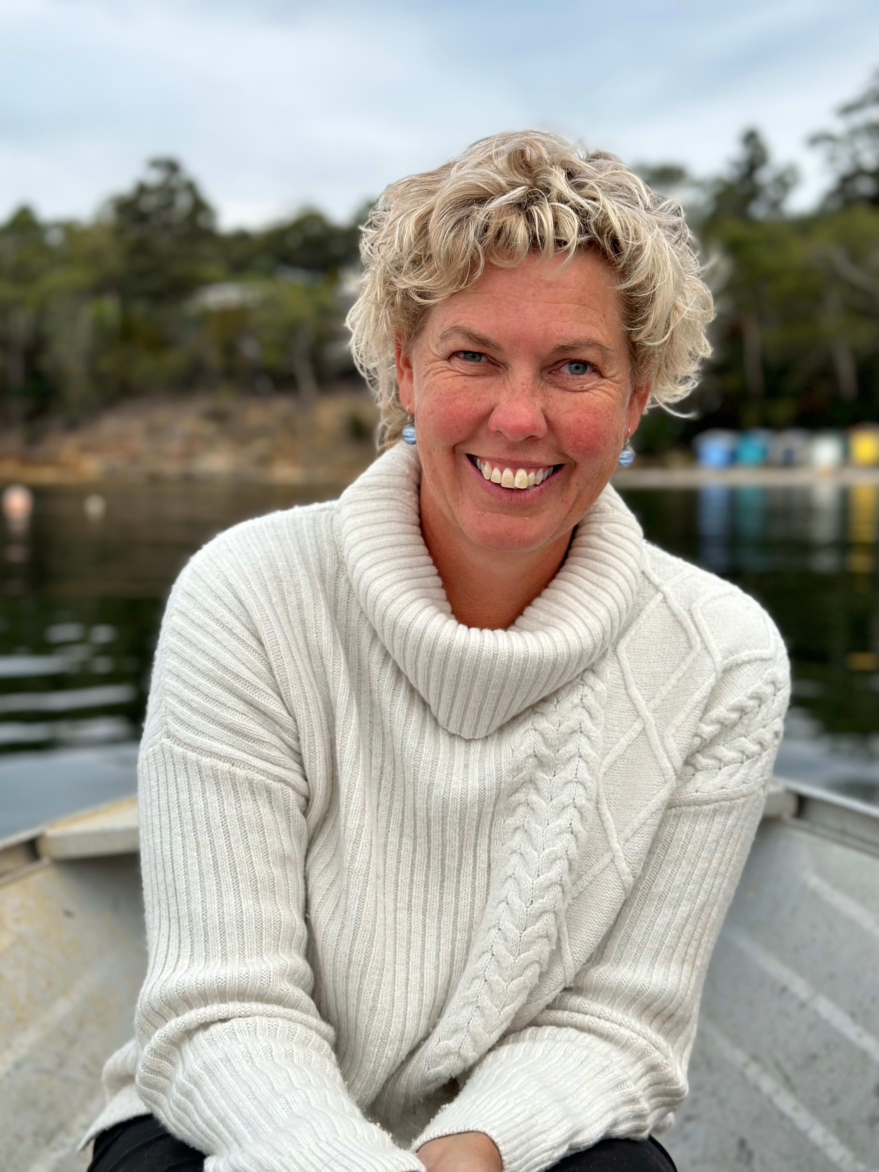
Pen Tayler is a Tasmanian writer and photographer. She photographed 12 towns for Towns of Tasmania, written by Bert Spinks, and has written and provided images for Hop Kilns of Tasmania (both Forty South Publishing). She is currently working on a book about Prospect and Belmont houses, Coal River Valley.