
photographers TERRY MULHERN and GARRY SIMS
The Tasmanian waratah (Telopea truncata) blooms in spring. Its flowers – scarlet with shocking pink highlights – seem incandescent when set against the muted grey-green backdrop of the bush. My heart bursts with joy every time I see one.
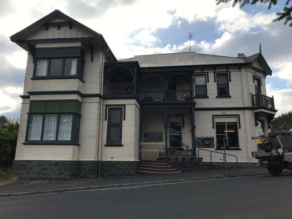
The town named after these gorgeous blossoms lies half-way between Burnie and the west coast. Fittingly, Waratah’s Main Street is lined with the eponymous evergreen shrubs. But by early January almost all the flowers have withered and dropped. So, we were fortunate to see the last waratah in Waratah in Queens Park, just across the road from the Bischoff Hotel.
Sleepy current-day Waratah belies its bustling past. Tin was discovered here by James “Philosopher” Smith in 1871. The Mount Bischoff tin mine, less than one kilometre uphill from the town’s one remaining pub, was once the richest in the world, and thousands flocked here seeking their fortune.
Waratah Falls. Photographer Garry Sims
The water flowing over Waratah Falls was harnessed to power machinery atop numerous wooden platforms perched precariously on the steep hillside. In the town’s heyday, the mine and Waratah’s streets were lit by hydroelectricity, a first in Australia. With the exception of Sunday, the metallic clang of “stamping” mills rang out 24 hours a day, as they pounded the ore into fine grey powder. Thousands of tons of processed ore were transported 70km to the coast at Burnie, at first by pack horse and bullock wagon, then by a wooden, horse-drawn tramway, itself eventually replaced by iron and steam.
Now, the mine is silent, mothballed behind a locked gate in a state of “care and maintenance”, and it’s hard to imagine that Waratah ever bustled.
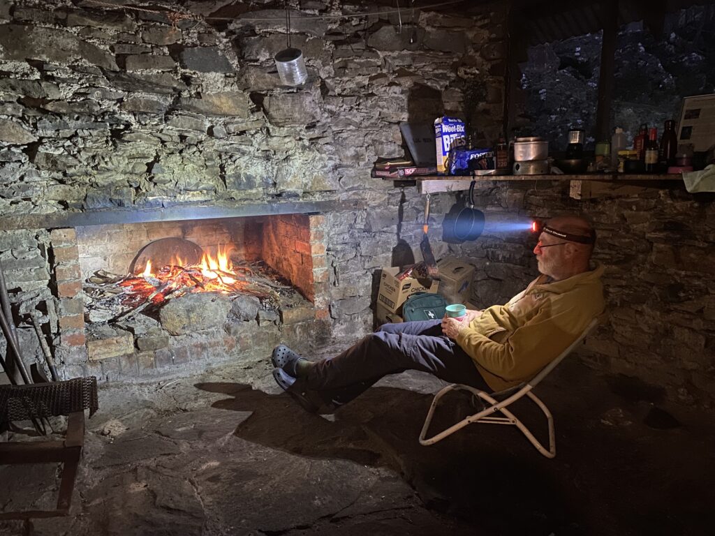
Despite this, the Bischoff Hotel still does a roaring trade. On a Tuesday evening we were lucky to get a table for dinner. The bar was lined with men in high-vis, and at every table were couples or families that we recognised from the campground behind the Athenaeum Hall or whom we had seen on the Philosophers Falls walking track the day before.
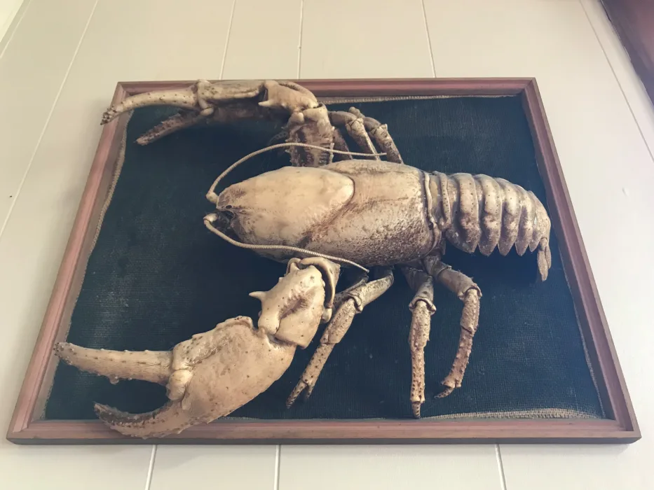
As I sipped my beer, I noticed a lobster mounted on the wall in an alcove. This was a reminder that Waratah is on the extreme southern limit of the range of the giant freshwater crayfish (Astacopsis gouldi).
When hauled out of a local stream, this lobster probably weighed three to four kilograms and could have been more than 40 years old. It would have been a glossy dark green to black, with fiery red splashes on its claws. Around its legs would have been grotesque clusters of chocolate-brown flat worms and, if it had recently moulted, it may have had electric blue patches on its armoured carapace.
But the process of taxidermy and the bleaching effect of the sun streaming in on it through the west-facing windows have turned it pale yellow. It reminded me of an enormous, prehistoric insect trapped in amber.
I don’t believe many lobsters have been caught in the vicinity of Waratah for quite a while. Tin, silver, lead and zinc mining has left more than a historical and cultural legacy here. Toxic heavy metals and acidified runoff from the Mount Bischoff and nearby Magnet mines have poisoned at least 20km of the Arthur River downstream of Waratah. From the river’s junction with Tinstone Creek until it is flushed clean by the Wandle and Hellyer Rivers, the Arthur is a sickly orange and almost completely devoid of aquatic life. The giant freshwater crayfish is locally extinct – “extirpated” is the term used by biologists.
“Extirpate” is not a word you come across often. It means to eradicate or destroy completely. It comes from the Latin “extirpare”, essentially meaning to rip something out by the roots. It was pretty common in 19th century English. The occurrence of “extirpate” peaked in Australian newspapers in the last decades of the 19th century and then went into a slow decline. By the 1950s, it had passed into linguistic obscurity. Interestingly, there was a massive spike in 1885, when it was used to describe the battle of the mainland colonies, particularly Victoria, with the rabbit plague engulfing them.
In Tasmania in the late 1820s, the term was often employed by impassioned newspaper editors and letter-writers clamouring for Lieutenant Governor Sir George Arthur – after whom the river is named – to deal with “the natives” whose daily “outrages” threatened the very existence of the colony.
Despite his faults, and there were many, Arthur was not an “extirpationist”. He was part of the emerging Anglican evangelical movement. Before his appointment to Van Diemen’s Land, he had served as lieutenant governor of British Honduras, where he had supported the abolition of slavery.
Yes, Arthur waged war against Tasmanian Aborigines, but for the most part he viewed them as military opponents, not criminals nor subhuman. To Arthur, captured warriors were prisoners of war and they were incarcerated, not hanged as murderers. The problem was that many of his soldiers, most of the landed gentry and virtually all their convict shepherds and stockkeepers, thought Arthur was weak and took matters into their own hands.
Waratah. Photographer Garry Sims
Waratah lies on the edge of the “Surrey Hills”. These elevated grasslands, once known as woollunnengar, were the summer hunting grounds of the noeteeler clan. And the noeteeler certainly were “extirpated”. In 1825, the Van Diemen’s Land Company received a Royal Charter that granted it a 250,000 acres in north-west Tasmania. In February 1827, the company’s chief surveyor, Henry Hellyer, found the ready-made woollunnengar pastures and claimed them for the company. Hellyer was sympathetic towards the plight of Aborigines, but also paternalistic. He supported the governor’s plan to capture all surviving Tasmanian Aborigines and transport them to Flinders Island “for their own protection”. Of the little more than 200 exiled to Flinders, not one was noeteeler.
Twice, Arthur’s “conciliator”, George Augustus Robinson, with his Aboriginal negotiators and translators, searched the Surrey Hills for the noeteeler, first in 1830 and again in 1834. But he couldn’t locate a single living member of the clan – just bones. This was unsurprising. The company’s assigned convicts and indentured servants proudly told Robinson they “shoot them when we see them”.
While in Waratah, we made a day trip to Corinna. We’d hoped to kayak on the Pieman River. But all the kayaks were booked out, so we boarded the MV Arcadia II for the cruise down to Pieman Heads. Tourist “experiences” are not my favourite thing and the commentary often makes me cringe. But I do love boats.
The old Huon pine vessel chugged along serenely, slipping through the inky black water leaving rhythmical undulations in its wake. The river twisted back and forth in its canyon-like valley, the steep hillsides cloaked in myrtle beech and towering eucalypt forest. Mount Donaldson, which looms over the Pieman’s confluence with the Donaldson River, was pointed out to us. But let me set the record straight – Donaldson was not a miner.
Stuart Donaldson (1776-1849) was a director of the Van Diemen’s Land Company. As a young man, Donaldson got a taste for colonial enterprise as the purser on ships owned by the Honourable East India Company. In 1824, he founded the London firm of Donaldson, Wilkinson & Co, which was the British agent for numerous colonial pastoralists. He never travelled to Australia, let alone Tasmania, and was never a miner. But his third son, Sir Stuart Alexander Donaldson (1812-1867) did emigrate, becoming a successful Sydney businessman and the first premier of self-governed New South Wales in 1856.
To curry favour with their superiors, Henry Hellyer and the other VDL Co surveyors named numerous geographical features after the company directors, including Mt Bischoff (James Bischoff), Borridaile Plain and Borridaile Creek (William Borridaile); Mt Campbell and Campbell Range (Alexander Campbell and/or James Campbell); Mt Cattley, Cattley Plain and Cattley Creek (John Cattley); Mt Dundas and Dundas River (James Dundas); Ellice Hill (Edward Ellice); Mt Everett (William Everett); Mt Hicks (Henry Hicks); Mt Inglis and Inglis River (James Inglis); Jacobs Boat Harbour (John Jacobs); and Mt Pearse (Brice Pearse).
On January 8, 1829, Hellyer set out on an arduous journey, exploring from the Surrey Hills to the west coast, passing near to where Waratah would eventually be built. On January 16, Hellyer found himself at the bottom of a deep and heavily wooded valley by the side of “a noble stream, being the third we crossed this journey all running S.W. and which I named the Donaldson”.
Curiously, this was not the same river pointed out by our skipper, but Savage River. Until the 1880s, maps switched the Donaldson and Savage as we know them today. But in the 1870s and ‘80s prospectors insisted on calling the river nearest the coast the Donaldson and this was eventually accepted by the Survey Department.
For better or worse we need to acknowledge and embrace our past. Both the good and the bad shape the natural environment and the society we live in today. But it’s worth the effort to do your homework and dig into our history. There are always fascinating stories to be told and lessons to be learnt.
Previous columns:
Lobster tales: After the flood
Lobster tales: Mr Gray’s mysterious collector, Part 2
Lobster tales: Mr Gray’s mysterious collector, Part 1
Lobster tales: Life underground
Lobster tales: Inside the mountain
Lobster tales: Old growth, new conflict
Lobster tales: William Buelow Gould
Lobster tales: Literary lobsters